Agriculture
Operating large-scale farmland efficiently KOMPSAT offer precisely calibrated optical sensors that support efficient agricultural operations across vast farmlands. Through regular monitoring, farmers and agribusinesses can detect regional drought stress, identify crop types and cultivated areas, and optimize planting and harvesting schedules. This helps stabilize food supply chains by aligning production with market demand, especially in regions with variable climate conditions like East Africa.
© 2025, KARI, distributed by SIIS
Download Sample Image
Click to download Agriculture sample
Agricultural Capabilities
Advanced satellite imagery solutions for efficient farming operations, crop monitoring, and precision agriculture.
Operating Large-Scale Farmland Efficiently
KOMPSAT offer precisely calibrated optical sensors that support efficient agricultural operations across vast farmlands. Through regular monitoring, farmers and agribusinesses can detect regional drought stress, identify crop types and cultivated areas, and optimize planting and harvesting schedules.
This helps stabilize food supply chains by aligning production with market demand, especially in regions with variable climate conditions like East Africa.
Drought Detection
Detect regional drought stress across large areas
Crop Identification
Identify crop types and cultivated areas
Schedule Optimization
Optimize planting and harvesting schedules
Crop Health & Growth Monitoring
Healthy vegetation reflects more near-infrared (NIR) light a property used in satellite-based crop vitality analysis. By combining NIR, red, and green bands into color imagery, KOMPSAT highlight healthy crops in vivid red tones. This enables:
- Visual assessment of growth vigor
- Early detection of stressed or underperforming areas
- Quantitative evaluation of plant health using vegetation indices (e.g., NDVI)
Farmers and agronomists can use this insight to make timely decisions on irrigation, fertilization, and disease management.
Growth Vigor Assessment
Visual assessment of crop growth vigor
Stress Detection
Early detection of stressed or underperforming areas
Vegetation Indices
Quantitative evaluation using NDVI and other indices
Smart Farming & Precision Agriculture
Satellite-based remote sensing with KOMPSAT enables the operation of intelligent, resource-efficient farms. Users can:
- Detect anomalies such as pest outbreaks or nutrient deficiencies early
- Apply water, pesticides, or fertilizer only where needed
- Monitor planting and harvesting timelines
- Create dynamic crop maps integrating sowing patterns and vegetation vitality
This supports sustainable agriculture, reduces input costs, and improves yield predictability, making it ideal for precision agriculture programs across Africa and beyond.
Pest Detection
Detect pest outbreaks and nutrient deficiencies early
Precision Application
Apply inputs only where needed
Dynamic Mapping
Create dynamic crop maps with sowing patterns
Sustainable Agriculture
Support sustainable and resource-efficient farming
Agriculture Examples
High-quality KOMPSAT imagery showcasing agricultural monitoring and precision farming capabilities.
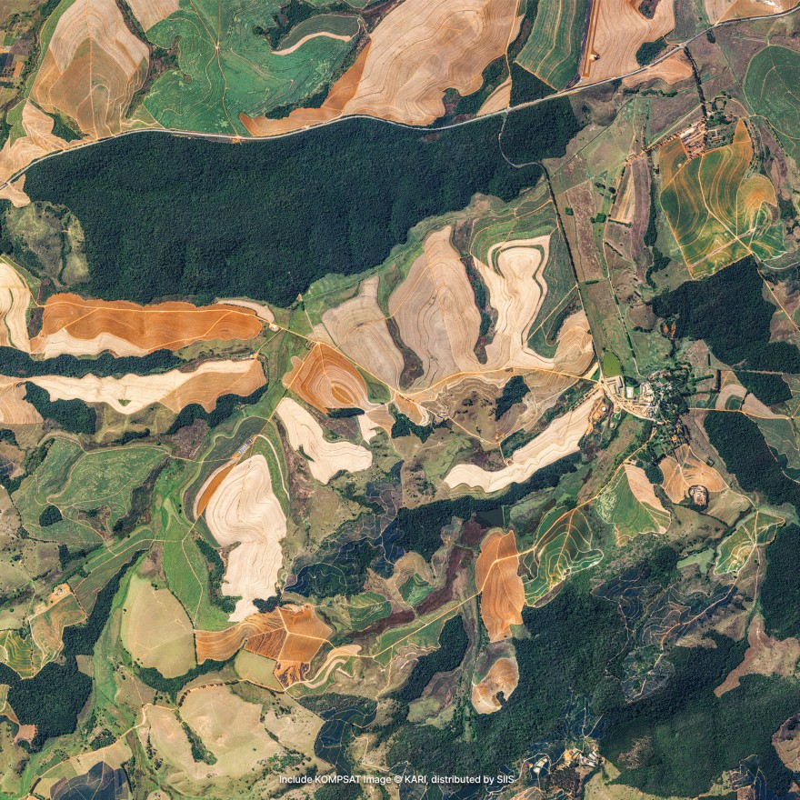
Large-Scale Farming
Efficient monitoring of vast agricultural operations and crop management.
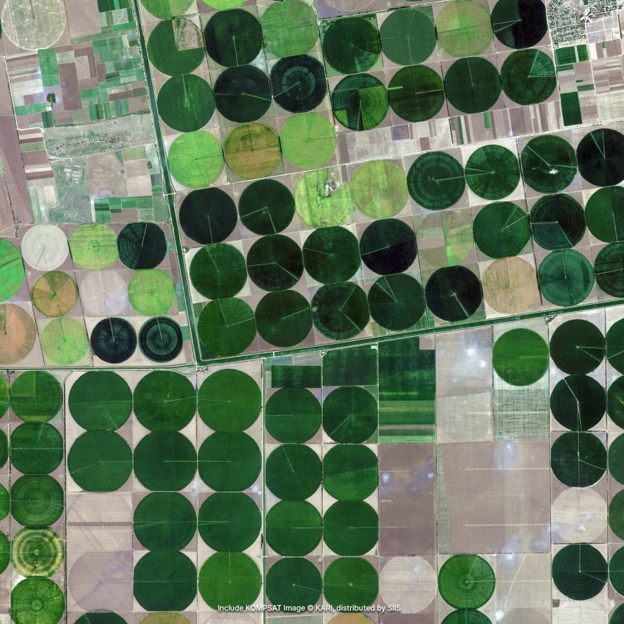
Crop Health Monitoring
Advanced crop vitality analysis using NIR and multispectral imagery.
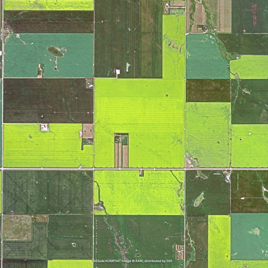
Precision Agriculture
Smart farming solutions for resource-efficient agricultural operations.
Request Agriculture Data
Get high-resolution satellite imagery for your agricultural monitoring and precision farming needs.
Place Your Imagery Order
Complete the form below to request satellite imagery. All fields marked with * are required.