Disaster Monitoring
KOMPSAT plays a critical role in global disaster response by providing timely satellite imagery to the International Charter on Space and Major Disasters, enabling rapid assessment of affected areas.
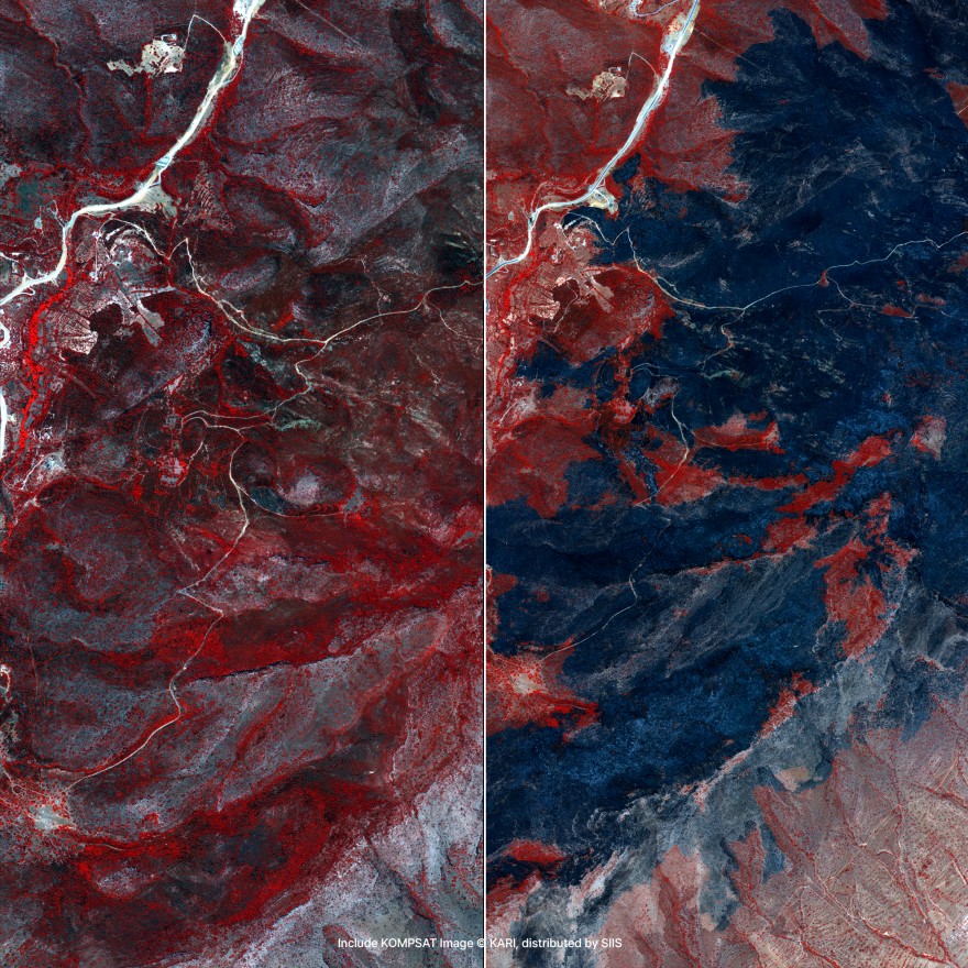
© 2025, KARI, distributed by SIIS
Disaster Response Capabilities
Comprehensive satellite imagery solutions for disaster response, climate monitoring, and environmental policy support.
Identifying and Monitoring Global Disasters
KOMPSAT plays a critical role in global disaster response by providing timely satellite imagery to the International Charter on Space and Major Disasters. This international cooperation mechanism enables rapid assessment of areas affected by large-scale disasters such as earthquakes, typhoons, floods, wildfires, snowstorms, and oil spills.
Through this initiative, KOMPSAT contributes over 500 high-resolution images annually to support emergency response and damage assessment in regions including Southeast Asia, Africa, and South America. These images are used by governments, humanitarian organizations, and relief agencies to:
- Map damage zones
- Prioritize rescue and restoration efforts
- Support post-disaster recovery planning
KOMPSAT also supports national disaster response efforts within Korea and internationally, helping identify the scale and impact of wildfires, landslides, and other catastrophic events.
Damage Assessment
Map damage zones and assess disaster impact
Rescue Operations
Prioritize rescue and restoration efforts
Recovery Planning
Support post-disaster recovery planning
Wildfire Monitoring
Identify scale and impact of wildfires and landslides
Climate Change Monitoring & Environmental Policy Support
In response to the escalating climate crisis, KOMPSAT is integral to global earth observation initiatives such as the Group on Earth Observation (GEO) and the Global Earth Observation System of Systems (GEOSS). These programs aim to strengthen climate action, environmental sustainability, and disaster resilience through shared satellite data.
In Korea, the Ministry of Science and ICT and the Korea Aerospace Research Institute (KARI) are actively expanding the use of KOMPSAT data through K-GEO, promoting:
- Climate change monitoring
- Greenhouse gas mapping and trend analysis
- Regional sustainability assessments
- Global competitiveness in Earth observation
As a reseller of SIIS imagery, we provide access to this valuable data for applications in climate adaptation planning, disaster preparedness, and environmental policy development across Africa and globally.
Climate Monitoring
Monitor climate change impacts and trends
Greenhouse Gas Mapping
Map greenhouse gas emissions and trends
Sustainability Assessment
Assess regional sustainability and environmental health
Policy Development
Support environmental policy and adaptation planning
Disaster Response Examples
High-quality KOMPSAT imagery showcasing disaster monitoring and emergency response capabilities.
Emergency Response
Rapid assessment and monitoring of disaster-affected areas for emergency response and recovery planning.
Request Disaster Data
Get high-resolution satellite imagery for your disaster monitoring and emergency response needs.