Maritime
KOMPSAT imagery, with ultra-high spatial resolution up to 0.24 meters, enables comprehensive maritime safety monitoring and environmental protection across coastal regions.
© 2025, KARI, distributed by SIIS
Maritime Capabilities
Advanced satellite imagery solutions for maritime safety, environmental protection, and coastal monitoring.
Illegal Vessel Detection
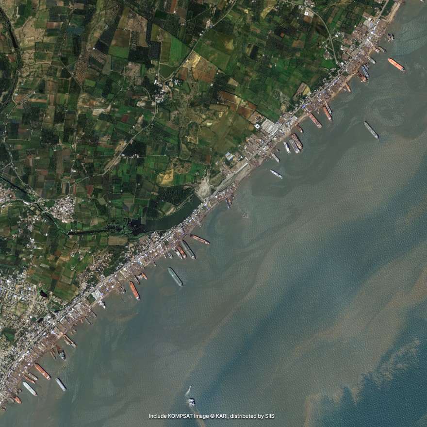
With ultra-high spatial resolution up to 0.24 meters, KOMPSAT imagery enables the detection of vessels even when they turn off their Automatic Identification System (AIS) to avoid tracking. Illegal fishing vessels operating without AIS leave no digital footprint, but their presence can still be visually identified through optical imagery.
By analyzing satellite data for ship shapes and shadows at specific locations and times, authorities can:
- Detect unregistered or suspicious vessels
- Monitor Exclusive Economic Zones (EEZs)
- Strengthening maritime law enforcement and anti-piracy operations
This capability is especially critical for coastal nations across East Africa and the Western Indian Ocean including Kenya, Tanzania, Somalia, and island states where illegal fishing affects marine ecosystems and national revenue.
Visual Identification
Identify vessels even without AIS tracking
EEZ Monitoring
Monitor Exclusive Economic Zones effectively
Law Enforcement
Strengthen maritime law enforcement operations
Anti-Piracy
Support anti-piracy and illegal fishing prevention
Oil Spills, Ship Accidents & Marine Hazards
KOMPSAT-5, equipped with Synthetic Aperture Radar (SAR), provides day-and-night, all-weather imaging ideal for maritime safety monitoring and environmental protection. SAR imagery can:
- Detect ships regardless of visibility conditions
- Monitor oil spills, marine collisions, and drifting vessels
- Track illegal discharge events in protected waters
In addition, both KOMPSAT imagery can support environmental analysis such as:
- Chlorophyll concentration changes
- Tracking of algal blooms and red tide spread
These tools offer essential insights for marine agencies, coast guards, port authorities, and environmental regulators.
SAR Imaging
Day-and-night, all-weather vessel detection
Oil Spill Detection
Monitor oil spills and marine collisions
Hazard Monitoring
Track illegal discharge events in protected waters
Environmental Analysis
Monitor chlorophyll changes and algal blooms
Maritime Examples
High-quality KOMPSAT imagery showcasing maritime monitoring and environmental protection capabilities.
Vessel Detection
Ultra-high resolution imagery for detecting vessels and monitoring maritime activities.
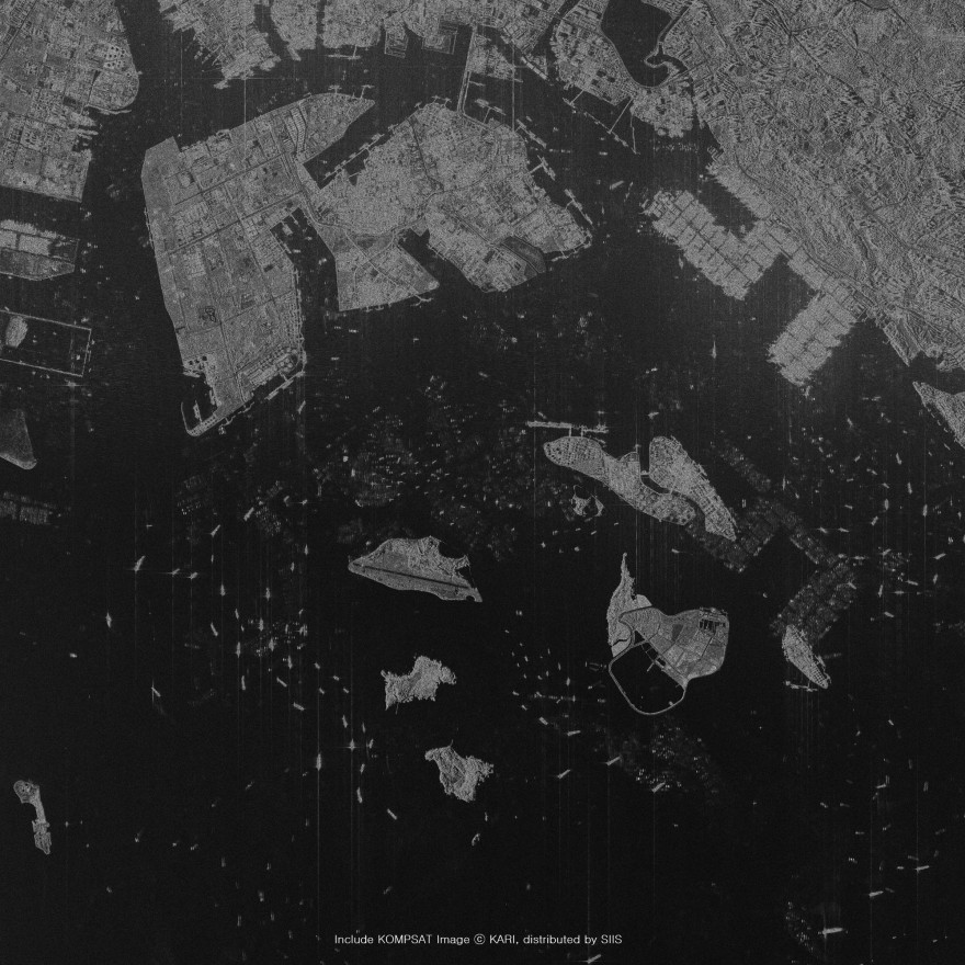
Environmental Protection
SAR and optical imagery for monitoring oil spills and marine environmental hazards.
Request Maritime Data
Get high-resolution satellite imagery for your maritime monitoring and environmental protection needs.