Infrastructure & Urban Planning
We provide clients across East Africa, Africa, and beyond with access to high-resolution satellite imagery enabling powerful insights across infrastructure development, urban monitoring, and planning.
© 2025, KARI, distributed by SIIS
Download Sample Image
Click to download Infrastructure sample
Infrastructure Capabilities
Comprehensive satellite imagery solutions for infrastructure development, urban monitoring, and economic planning.
Large-Scale Infrastructure Construction
KOMPSAT imagery has been successfully applied to monitor the progress of large-scale infrastructure projects around the world, such as the 3.6 km Canakkale Suspension Bridge in Turkey, the world's longest suspension bridge, and the 15.5 km breakwater in Basra, Iraq.
By acquiring satellite images from the same angle and time intervals, our clients can easily measure structural dimensions, verify construction phases, and assess whether projects are progressing on schedule. This approach is ideal for monitoring roads, bridges, ports, airports, and other civil works across Africa and globally.
Structural Monitoring
Measure dimensions and verify construction phases
Progress Tracking
Assess project schedules and timeline compliance
Civil Works
Monitor roads, bridges, ports, and airports
Urban Change Detection
Urban growth often varies in pattern, older cities evolve organically with irregular roads and mixed land use, while new towns and planned cities display more linear and formal layouts.
KOMPSAT's high-resolution data allows users to detect and analyze these urban morphology patterns through pixel structure and spatial arrangement. This supports change detection, urban sprawl monitoring, and city expansion analysis for local authorities, planners, and developers.
Pattern Analysis
Analyze urban morphology through pixel structure
Sprawl Monitoring
Track urban expansion and development patterns
Planning Support
Assist local authorities and developers
Economic and Urban Planning
Nighttime satellite imagery from KOMPSAT provides a powerful proxy for estimating economic activity. The brightness and density of city lights can be used to infer standards of living, economic vitality, and urban energy use.
In daylight imagery, features like supermarket parking lots or warehouse activity can indicate income levels and consumer behavior. Combined with spatial analysis of underdeveloped or unplanned areas, this information supports data-driven economic development strategies and urban master planning across rapidly growing regions.
Economic Indicators
Analyze city lights for economic activity assessment
Consumer Behavior
Identify income levels through commercial activity
Master Planning
Support data-driven urban development strategies
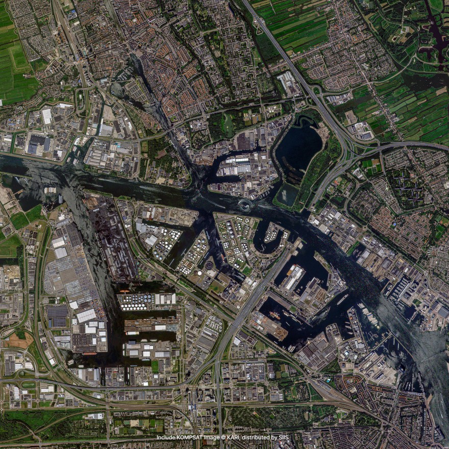
Infrastructure Examples
High-quality KOMPSAT imagery showcasing infrastructure monitoring and urban planning capabilities.
Large-Scale Construction
Monitoring major infrastructure projects including bridges, ports, and transportation networks.
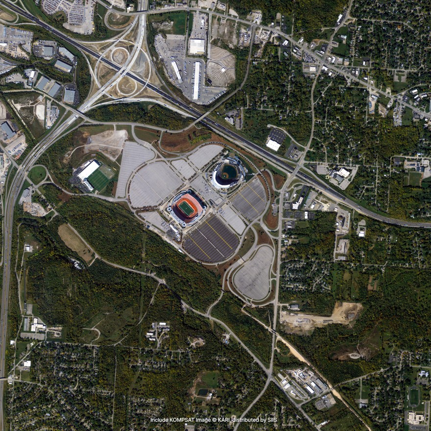
Urban Development
Tracking urban growth patterns and supporting city planning initiatives.
Request Infrastructure Data
Get high-resolution satellite imagery for your infrastructure development and urban planning projects.
Place Your Imagery Order
Complete the form below to request satellite imagery. All fields marked with * are required.