
Accurate and reliable satellite imagery and geospatial data is the foundation of smart decision-making. Whether for mapping, urban planning, environmental planning, infrastructure development, agriculture, disaster response, or marine surveillance, the demand for high-resolution satellite imagery data is evident.
By recognizing the growing need for accurate, affordable and reliable satellite imagery, we are now availing KOMPSAT imagery directly in Africa. This milestone empowers organizations and professionals across Kenya, East Africa, Africa, and beyond with world-class data at resolutions of up to 30 cm. With KOMPSAT imagery, industries can unlock new opportunities for precision, innovation, and informed decision-making across diverse applications.
We are providing more than just access to KOMPSAT imagery, we are equipping organizations with a powerful decision-support tool that transforms the way they see, plan, and act on the world around them.
At Geosurveys and Geospatial Information Limited (GGIL), we understand this data need firsthand, we are not only consumers of satellite imagery and geospatial technologies, but now a bridge connecting clients to world-class imagery solutions.
In our projects, we’ve seen how the right data sharpens planning, reduces risks, unlocks revenue streams, and drives cost savings.
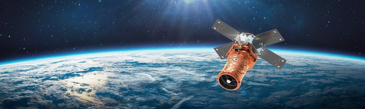
FROM SPACE TO CLARITY: KOMPSAT Imagery Specifications.

KOMPSAT 3A – Ultra-high-resolution 40 cm PAN / 1.6 m MS with stereo imaging for DEM/DSM generation and true 3D terrain modeling. Perfect for flood risk mapping, slope stability monitoring, infrastructure design, agriculture, environmental applications, urban planning and city modeling.
KOMPSAT 3 - 50 cm PAN / 2 m MS with wide swath coverage and daily revisit. Its stereo capability supports large-scale DEM/DSM creation, enabling forestry management, regional landscape studies, agriculture, urban planning and disaster preparedness.
KOMPSAT 2 – Proven 1 m PAN / 4 m MS sensor, trusted for agriculture monitoring, crop yield estimation, and land-use planning. Cost-effective and reliable for baseline mapping and resource management.
KOMPSAT 5 (SAR) - 0.85 m radar imagery with all-weather, day/night capability. Delivers InSAR-based ground deformation monitoring, oil spill detection, maritime surveillance, and change analysis even under cloud cover.
SpaceEye-T (2025) – Next-generation Satellite as a Service (SaaS) 25 cm PAN / 1 m MS with <1-day revisit, designed for hyper-detailed monitoring.
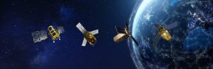
Upcoming Missions: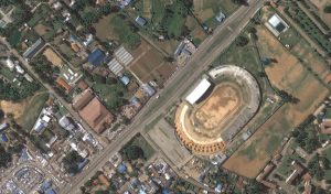
KOMPSAT-6- Advanced X-band SAR sensor with up to 0.5 m resolution, delivering all-weather, day-and-night monitoring. Ideal for disaster management, maritime surveillance, and infrastructure monitoring. Reliable for consistent data regardless of cloud cover.
KOMPSAT-7- Ultra-high-resolution optical mission offering 30 cm PAN and 1.2 m MS imagery. Designed for precision mapping, urban planning, and defense applications. Provides world-class clarity for detailed analysis.
KOMPSAT-7A – Enhanced mission adding high-resolution (30cm) infrared (IR) imaging to optical capabilities. Supports environmental monitoring, thermal anomaly detection, and urban heat studies. Expands earth observation into both visible and thermal domains.
From KOMPSAT’s satellites GGIL makes world-class satellite imagery accessible where it matters most, here in Africa. You just can’t get it wrong.
- See what others miss: from building footprints and road networks to hidden coastal activity.
- Track change in motion: monitor cities, crops, and coastlines with daily revisit.
- Never miss a moment: radar imaging delivers clarity in clouds, rain, or darkness.
- Model the terrain in 3D: generate DEMs/DSMs for engineering, planning, and risk analysis.
- World-class at African value: unmatched quality, competitively priced for the market.
“This is not just satellite imagery, it’s decision-ready intelligence that transforms how you plan and prosper.”
FROM SPACE TO SOLUTIONS : Industries we Empower.
- Governments: Design smarter policies, modernize land records, enhance physical planning, environmental conservation, crop monitoring, disaster response and monitor large infrastructure implementation with unmatched clarity, timeliness and detail.
- Environmentalists and NGOs: Track Forest cover, monitor fragile ecosystems, and measure climate change impacts. KOMPSAT’s reliable data strengthens conservation efforts and supports carbon monitoring initiatives, validating carbon credits and attracting climate finance.
- Disaster managers: Respond faster to floods, fires, landslides, and oil spills with near real-time mapping and accurate damage assessment. With daily revisit capability, decision-makers gain a crucial edge in saving lives and restoring normalcy quickly.
- Oil and gas companies: Estimate tank volumes, monitor refinery and pipeline projects, site suitability and detect pollution risks. KOMPSAT imagery reduces inspection costs, ensures compliance, and safeguards critical revenue streams.
- Marine and fisheries authorities: Detect illegal vessels, safeguard EEZs, and monitor oil spills even under cloud cover or at night. SAR imagery turns maritime security into a proactive shield against illegal activity.
- Agriculture and agribusiness: Use spectral analysis to track crop health, forecast yields, and detect drought stress. Early action means farmers save money, boost yields, and governments stabilize food supplies and agricultural revenues.
- Defense and security: Enhance National Security with affordable, intelligence-grade insights into facilities, borders, and movement patterns. KOMPSAT imagery provides strategic advantage with reduced ground risk.
Built environment professionals (GIS experts, surveyors, urban planners, developers, architects and engineers): Detect land-use changes, generate DEMs and DSMs for 3D modeling, and monitor city growth. Up-to-date imagery ensures future-proof plans, reduces costly mistakes, and drives sustainable urban development.
Work with us
Through GGIL, you can now access KOMPSAT satellite imagery supported by local expertise and a clear understanding of Africa’s needs.
Contact us today and gain access to data that transforms uncertainty into clarity, and decisions into lasting impact.